

Touch GIS app for iPhone and iPad
Developer: Touch GIS
First release : 04 Nov 2019
App size: 59.64 Mb
Touch GIS offers professional-grade field data collection and visualization.
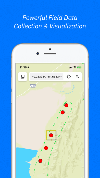
Data Collection For The Mobile Era
Powerful mobile devices are transforming how we work in the field. Touch GIS takes full advantage of the device you already have in your pocket, making field data collection easier than ever.
FEATURES
- Intuitive Interface
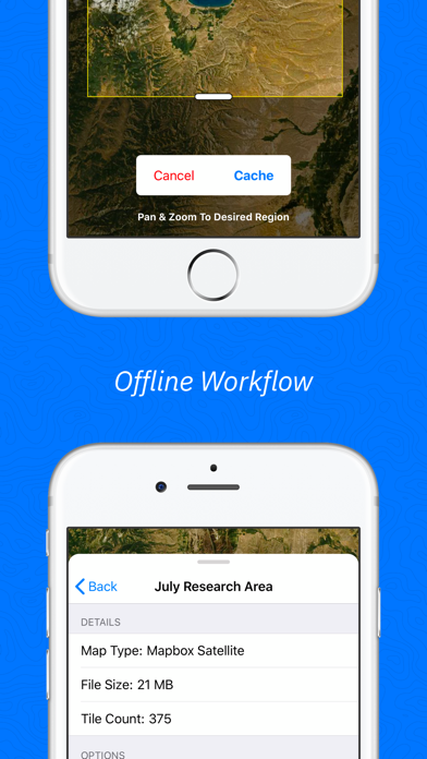
- Offline Capabilities
- Map Caching
- Robust File Support
- Customizable Attribute Forms
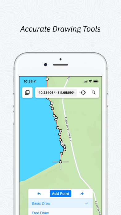
- Point, Line, Polygon, and Circle Features
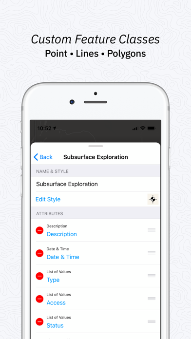
- Custom Feature Classes
- Preloaded Feature Class Templates
- WMS/WMTS Support
- Raster Image Support
FILE TYPES SUPPORTED
- Shapefile
- KML/KMZ
- GeoJSON
- GPX
- CSV (Export)
- World File
- Geotiff
CUSTOM FORMS
- Description
- Date & Time
- Photo
- List Of Values
- Checkbox
- Address
- Number
- Website
- Phone Number
PRELOADED FEATURE CLASSES
- Forestry
- Geology
- Real Estate
- Stream Surveys
- Water Infrastructure
- Wetlands
- Create Your Own!
Terms of Service: https://www.touchgis.app/privacy